
The Future of Aerial Surveillance: How Long-Range UAVs Are Redefining Coverage, Precision and Intelligence
· 4 min read
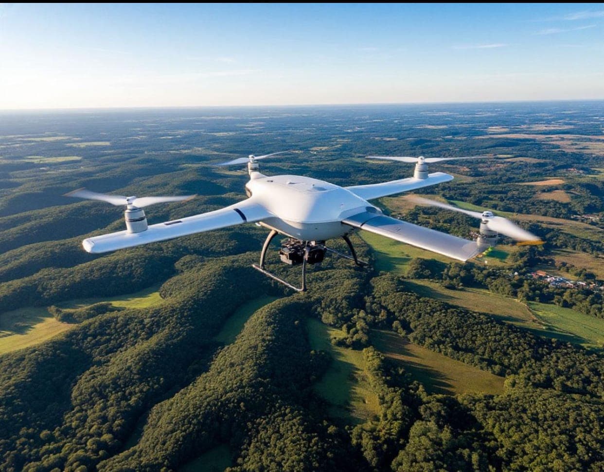
Aerial surveillance is evolving beyond conventional observation into a technology-driven capability that combines extended flight range, high-definition imaging, advanced sensors and intelligent data analysis. As security, infrastructure management and environmental monitoring become increasingly complex, the ability to gather reliable information across wider geographical areas is becoming an important part of modern operational planning.
Unmanned Aerial Vehicles (UAVs) are contributing significantly to this transformation. Unlike conventional crewed aircraft, these platforms can conduct surveillance missions without placing an onboard crew directly within the observation environment. Their flexibility, combined with advances in flight endurance, imaging systems and sensor technology, is expanding the possibilities for monitoring remote locations, critical infrastructure and areas that may be difficult to access from the ground.
One of the defining developments is the emergence of long-range, high-definition UAVs. These platforms are designed to extend surveillance reach while providing detailed visual information that can support situational awareness and operational assessment. Their value, however, goes beyond how far they can fly or the quality of images they capture. The effectiveness of an aerial surveillance system depends on how well its flight capabilities, sensors and information-processing systems work together.
The Relationship Between Altitude, Coverage and Precision
Altitude remains one of the fundamental considerations in aerial surveillance. The height at which a platform operates influences the geographical area it can observe and the level of detail available in the resulting imagery.
Higher operating altitudes generally provide wider ground coverage, making them useful for monitoring larger areas. Lower altitudes, depending on the sensor and imaging configuration, can provide more detailed observations over a smaller geographical area. This creates an important balance between broad-area coverage and image precision.
Modern aerial platforms are increasingly equipped with advanced optical cameras, infrared sensors and other imaging technologies that help manage this balance. High-definition optical systems can capture detailed visual information, while infrared and thermal imaging technologies can support observation in low-light conditions or identify differences in heat signatures.
Radar-based sensing can provide additional monitoring capabilities in certain environmental conditions, including situations where visibility is limited by cloud cover. The suitability of each sensor depends on the mission objective, operating environment and technical configuration of the platform.
Consequently, altitude alone does not determine the quality of aerial surveillance. The combination of flight parameters, sensor capability, environmental conditions and mission requirements ultimately determines the usefulness of the information collected.
From Aerial Observation to Intelligent Information
The next stage in the evolution of aerial surveillance is the transformation of collected imagery into useful intelligence.
Modern surveillance platforms can generate significant volumes of visual and sensor information. Without appropriate processing and analysis, however, the quantity of data collected does not automatically translate into better understanding.
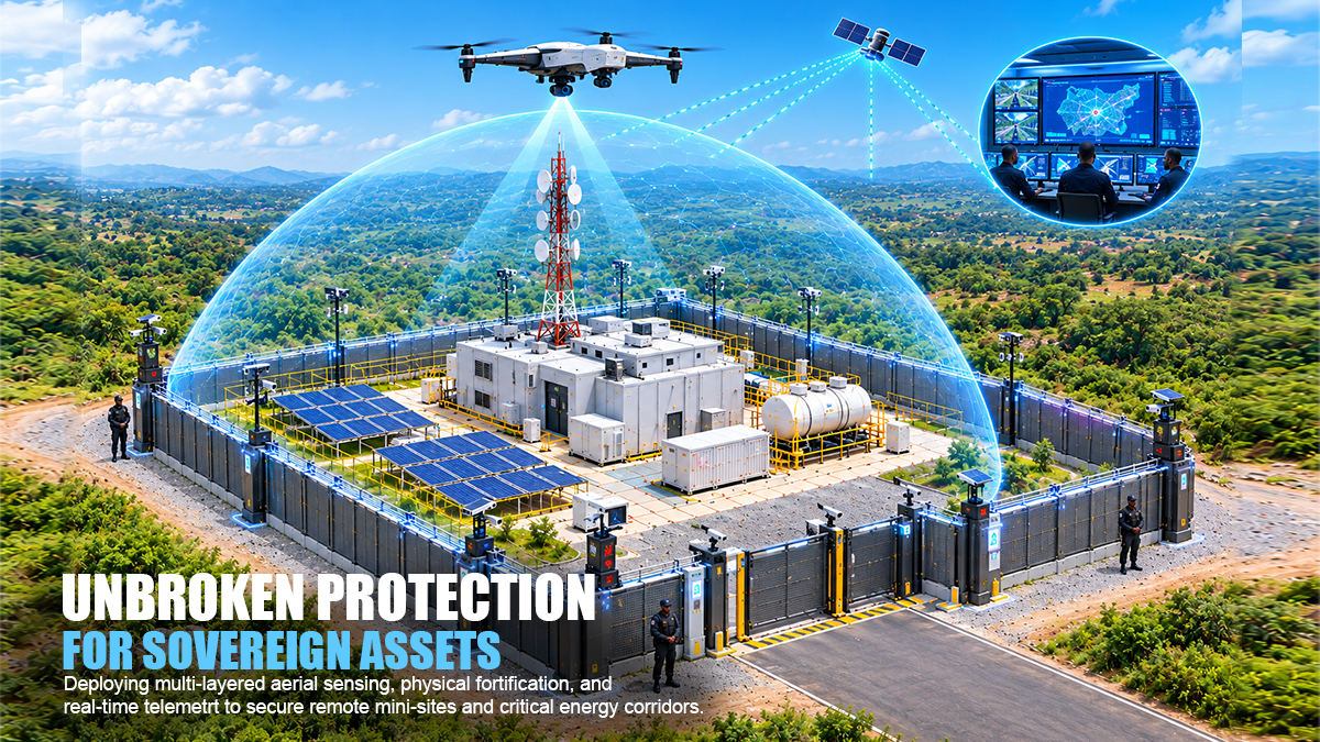
Digital processing, geospatial analysis and increasingly automated analytical tools are helping surveillance teams interpret information more efficiently. By examining imagery alongside geographical data and other relevant intelligence sources, operators can identify patterns, monitor changes and develop a more comprehensive understanding of an area.
This integration is particularly relevant to applications such as infrastructure monitoring, security operations, environmental observation, mapping and asset protection.
The growing importance of data integration also means that aerial surveillance systems are becoming part of wider digital intelligence environments. Their value increasingly depends on how effectively information can be processed, interpreted and presented to support informed decisions.
Long-Range UAVs and the Expanding Reach of Surveillance
Long-range UAV technology is expanding the geographical reach of aerial observation. The ability to monitor remote or difficult-to-access locations offers important advantages for organisations responsible for security, infrastructure and environmental management.
High-definition imaging further strengthens this capability by providing more detailed visual information for assessment. When combined with suitable sensors and analytical systems, long-range platforms can support a broader understanding of conditions across monitored environments.
EIB STRATOC is advancing its unmanned aerial capabilities through the deployment of advanced long-range, high-definition UAVs. This development reflects the growing importance of unmanned systems in modern surveillance and reconnaissance, particularly where extended observation, operational flexibility and detailed information gathering are required.
The broader significance of these platforms lies in the relationship between aerial reach and information quality. A surveillance system must do more than observe a location from a distance. It must generate information that can be interpreted and applied in line with clearly defined operational requirements.
The Importance of Responsible Deployment
As aerial surveillance capabilities become more sophisticated, responsible deployment remains essential.
UAV operations must comply with applicable aviation regulations, airspace restrictions and relevant operational requirements. Privacy, data protection and the lawful use of surveillance information must also be considered throughout the planning and execution of missions.
The increasing ability to collect detailed information creates a corresponding responsibility to establish clear purposes for data collection, appropriate access controls and accountable information-management procedures.
Operational effectiveness must therefore be considered alongside regulatory compliance, technical reliability and responsible data handling.
Looking Ahead: The Integration of Platforms, Sensors and Intelligence
The future of aerial surveillance will be shaped by the continued integration of unmanned platforms, advanced sensors, digital processing and intelligent analysis.
Longer flight ranges and improved imaging systems will remain important, but the next stage of development will depend increasingly on how effectively these technologies work together. The ability to combine aerial imagery with geospatial information, process data efficiently and communicate relevant findings will continue to influence the value of surveillance systems.
For organisations investing in unmanned aerial technology, the challenge is no longer simply to achieve greater altitude, wider coverage or higher image resolution. It is to connect these capabilities into systems that provide reliable information and support informed decision-making.
As UAV technology continues to advance, aerial surveillance will increasingly be defined by the quality of intelligence generated from the information collected. The convergence of flight capability, sensor precision and digital analysis is shaping a new generation of aerial systems with wider applications across security, infrastructure, environmental monitoring and strategic operations.